
OPEN BOX Navionics Platinum+ NPUS008R - U.S. West
Condition: This item is an Open-Box product. It has been inspected to ensure it is in working condition. While the item itself is in new or like new condition, the original retail packaging may show cosmetic wear, or may be unsealed/re-boxed.
Warranty: This item may not carry the original manufacturer's warranty, but is backed by our standard 30-day return policy.
OPEN BOX Navionics Platinum+™ NPUS008R – U.S. West
Navigate with confidence using Navionics Platinum+™ NPUS008R – U.S. West, delivering premium marine mapping with detailed coastal and inland coverage. Featuring advanced charting, high-definition bathymetry, relief shading, satellite imagery, and daily updates, Platinum+ provides the tools anglers and boaters need to fish smarter and navigate safely.
Designed for compatible chartplotters, Platinum+ combines detailed mapping with advanced navigation features to help you locate structure, plan routes, and explore new waters with confidence.
Key Features
Premium Navionics Platinum+™ Charts – Includes all Navionics+ features plus enhanced premium map layers.
High-Definition SonarChart™ Bathymetry – 1' (0.5 m) HD contour maps provide exceptional underwater detail.
Relief Shading – Clearly visualize bottom structure and depth changes.
Satellite Imagery with SonarChart™ Overlay – Enhanced above and below water awareness.
Sonar Imagery – View bottom hardness with detailed color imagery.
3D View – View charts from multiple perspectives for improved navigation.
Aerial Photography – Identify marinas, inlets, and shoreline features with ease.
Dock-to-Dock Route Guidance – Suggested routes through channels, marina entrances, and waterways.*
SonarChart™ Live Mapping – Create custom HD maps in real time on compatible chartplotters.
Plotter Sync – Wirelessly transfer routes, markers, and chart updates with the Navionics Boating App.
Community Edits – Access valuable local knowledge shared by fellow boaters.
Daily Chart Updates – Receive up to 5,000 chart updates each day.
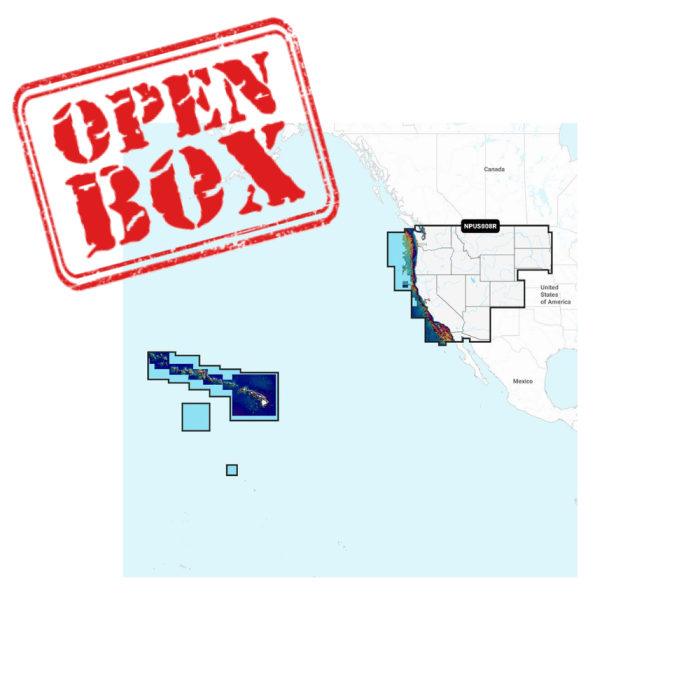
Coverage Area
Includes inland lakes, rivers, and coastal waters for:
Arizona
California
Colorado
Hawaii
Idaho
Montana
Nevada
North Dakota
Oregon
South Dakota
Utah
Washington
Wyoming
Johnston Atoll
Palmyra Atoll
Specifications
Chart Code: NPUS008R
Format: SD / microSD Card
What's Included
Navionics Platinum+™ NPUS008R SD/microSD Chart Card
Important Information
Compatible with select chartplotters that support Navionics Platinum+™ cartography.
Dock-to-Dock Route Guidance is intended for planning purposes only and does not replace safe navigation.
SonarChart™ Live availability may vary by chartplotter model and firmware version.
Navionics+™ and Platinum+™ cards are not compatible with Garmin® chartplotters.
Sold individually.